- Description
Garmin GPSMAP® 1543XSV Sidevu, Clearvu and Traditional CHIRP Sonar with Mapping - 010-03855-01
WIDEN YOUR HORIZONS
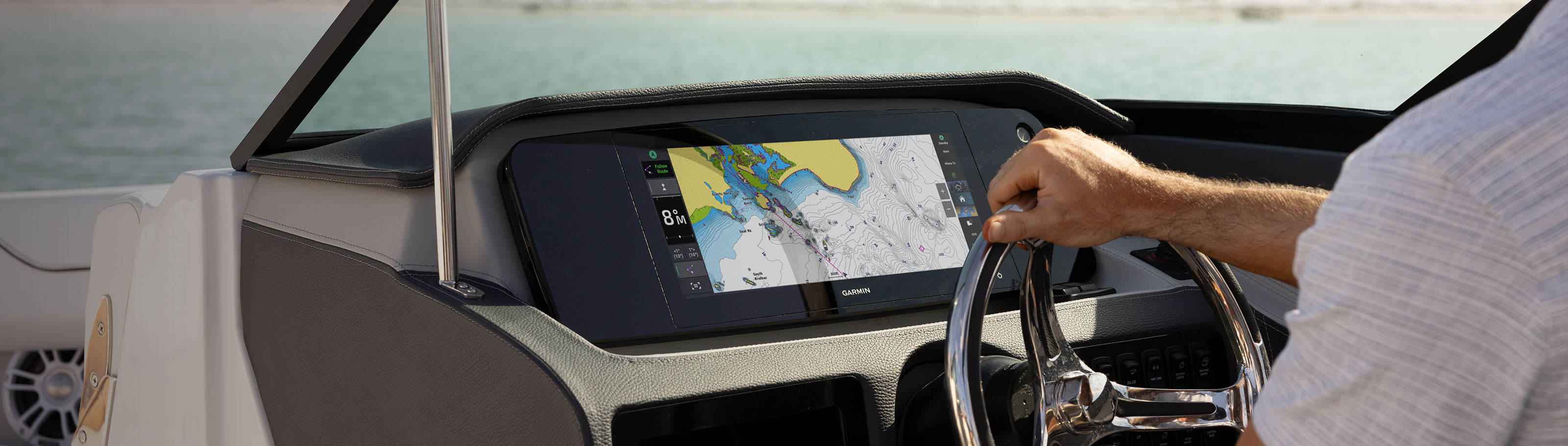
Offering a sleek aesthetic in an ultrawide edge-to-edge glass format, this advanced 15-inch chartplotter clearly expands your perspective at the helm. It is 74% wider and boasts more pixels than a standard 9-inch chartplotter, providing enhanced viewing clarity.
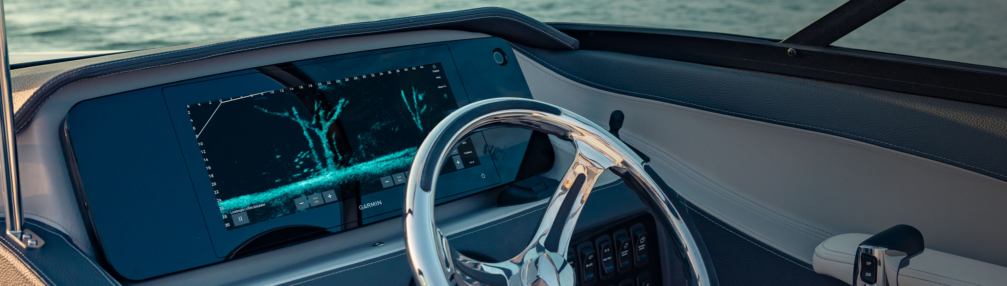
ULTRAWIDE IN-PLANE SWITCHING (IPS) 15-INCH DISPLAY FITS A VARIETY OF HELM LAYOUTS, INCLUDING “FLOATING DISPLAY” CONFIGURATIONS
CONNECT TO COMPATIBLE THIRD-PARTY DEVICES WITH DIGITAL SWITCHING AND ONEHELM™ INTEGRATIONS
EASILY BUILD YOUR MARINE SYSTEM BY USING OUR ADVANCED NETWORK CONNECTIVITY
NAVIGATE WATERS CONFIDENTLY WITH PRELOADED GARMIN NAVIONICS+™ CHARTS ON SELECT MODELS
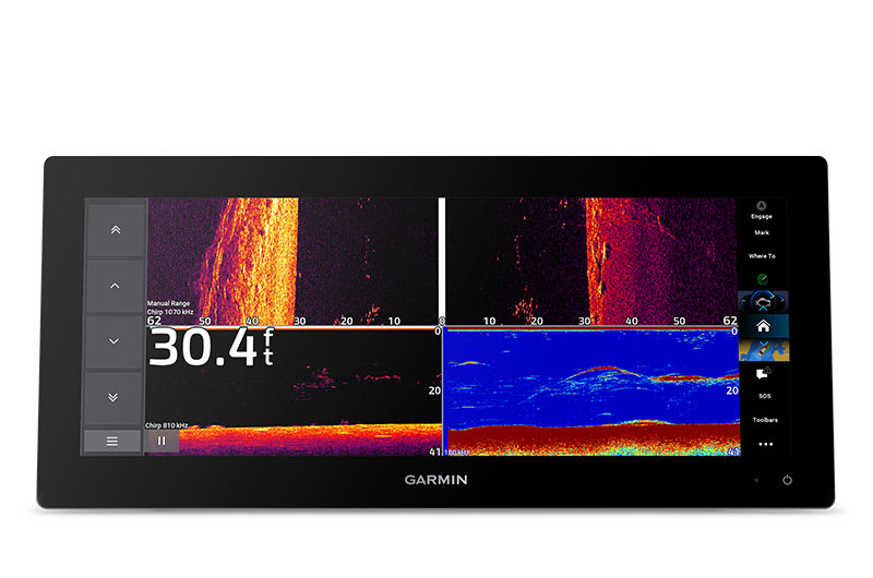
SEE BELOW YOUR BOAT WITH BUILT-IN SONAR CAPABILITIES
MANAGE YOUR MARINE EXPERIENCE FROM NEARLY ANYWHERE1

Gain a panoramic perspective.
SLEEK MODERN DESIGN
Offering a stunning display, with minimal trim borders and edge-to-edge glass, the GPSMAP 15x3 chartplotter features an ultrawide, high-resolution touchscreen interface with the familiar, easy-to-use functionality of our existing GPSMAP x3 series chartplotters.
BRIGHT AND CLEAR OPTICS
This versatile chartplotter’s ultrawide IPS display provides wider viewing angles, accurate colors, superior clarity and sunlight readability — even with polarized sunglasses.
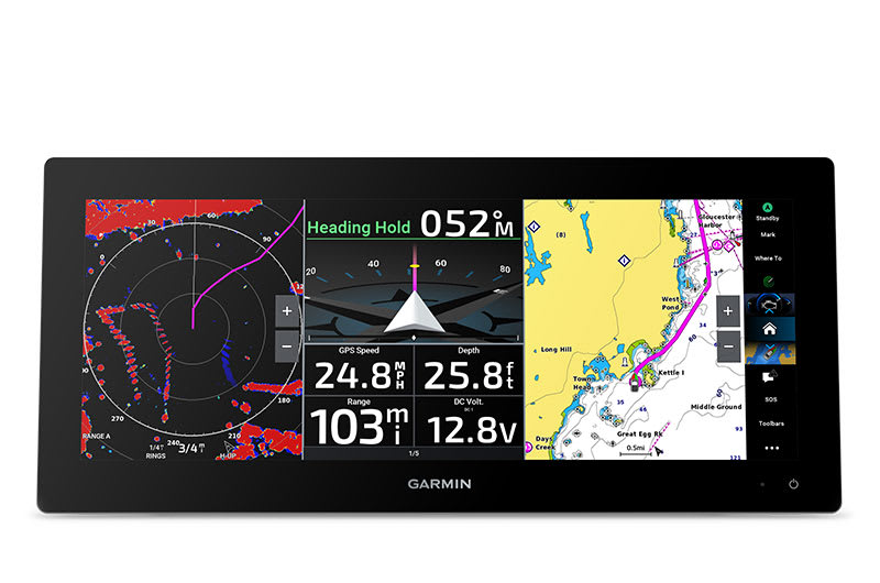
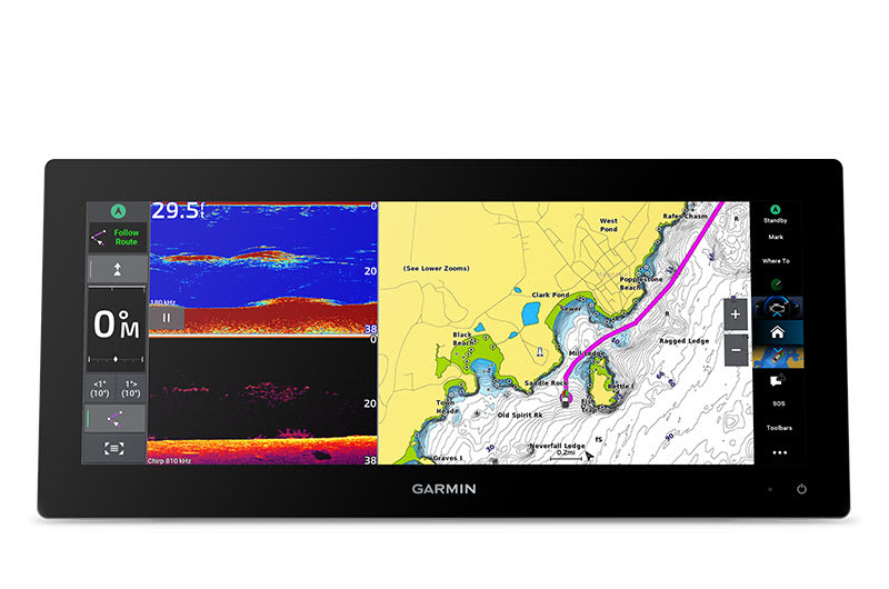
SPLIT TO FIT
Experience the benefits of dual screens with the convenience of seamless control. Split-screen functionality lets you size and organize your display configuration to put the data you need right where you want it.
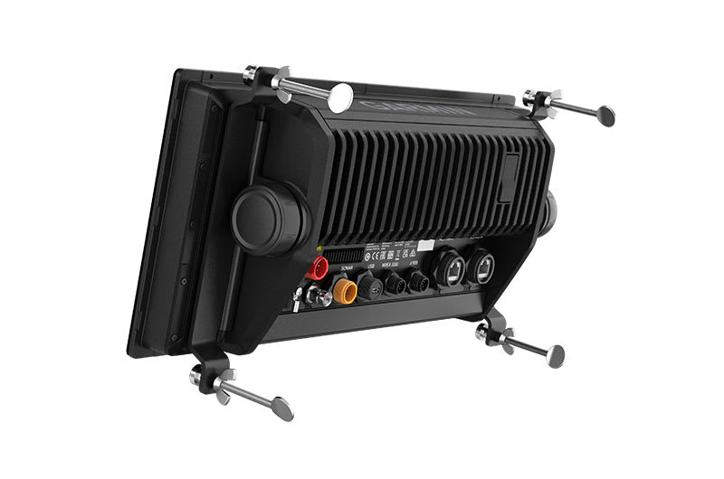
TWO MOUNTING OPTIONS
A bail-mount option with inset knobs and a bracket supports unique “floating display” installations, while a rear-mount option is provided for secure flush- and flat-mount helm solutions.
See the world below.
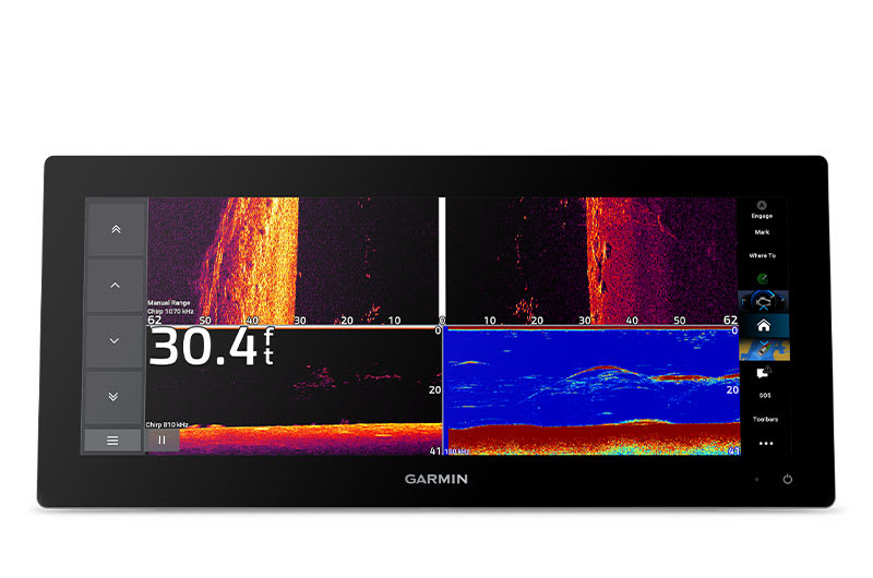
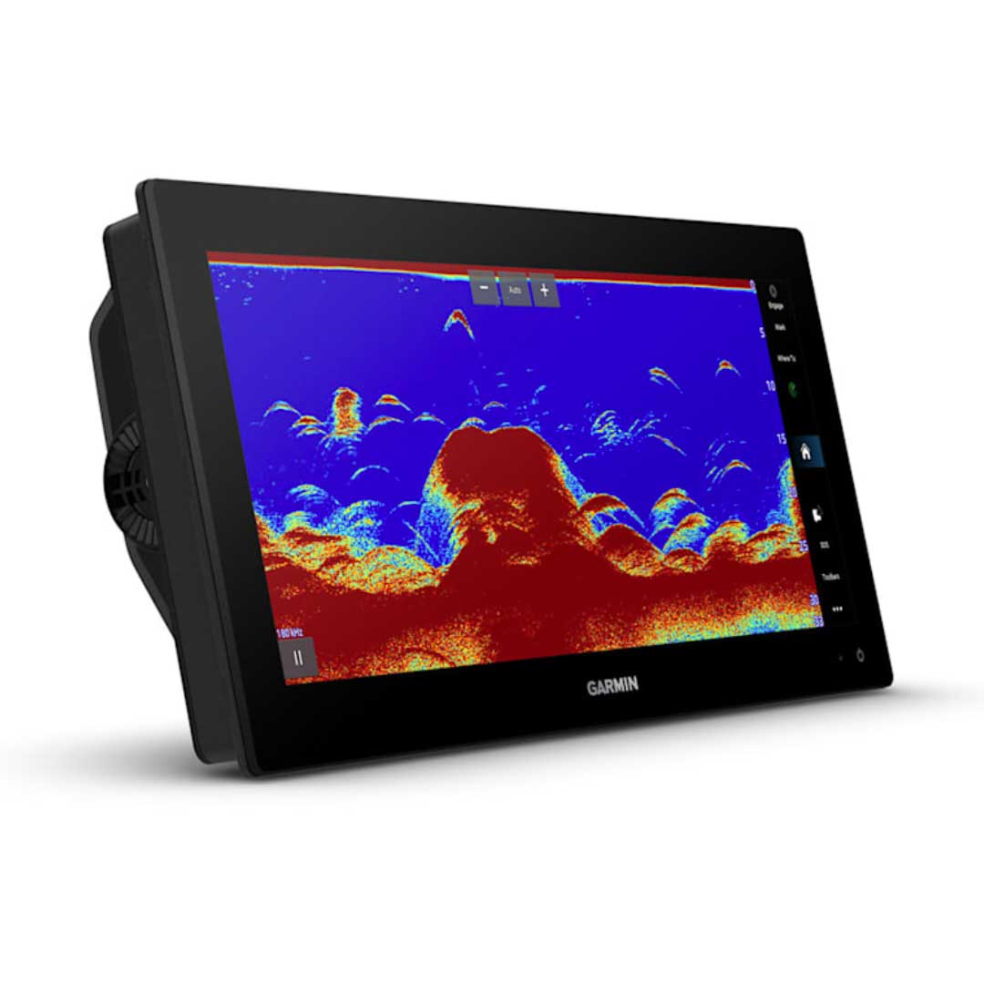
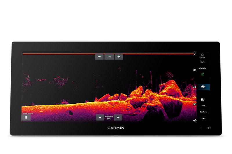
TRADITIONAL AND SCANNING SONAR SUPPORT
Get built-in support for 1 kW CHIRP traditional sonar for superior target separation. Plus, Ultra High-Definition ClearVü™ and SideVü™ scanning sonars feature vivid, high-contrast color palettes to help distinguish fish from structure (transducer required; sold separately).
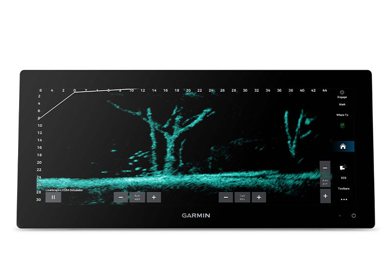
LIVE SONAR SUPPORT
Pair with Panoptix™ or LiveScope™ easy-to-interpret live sonar (transducer required; sold separately) to see all around your boat in real time.
Made for your helm.
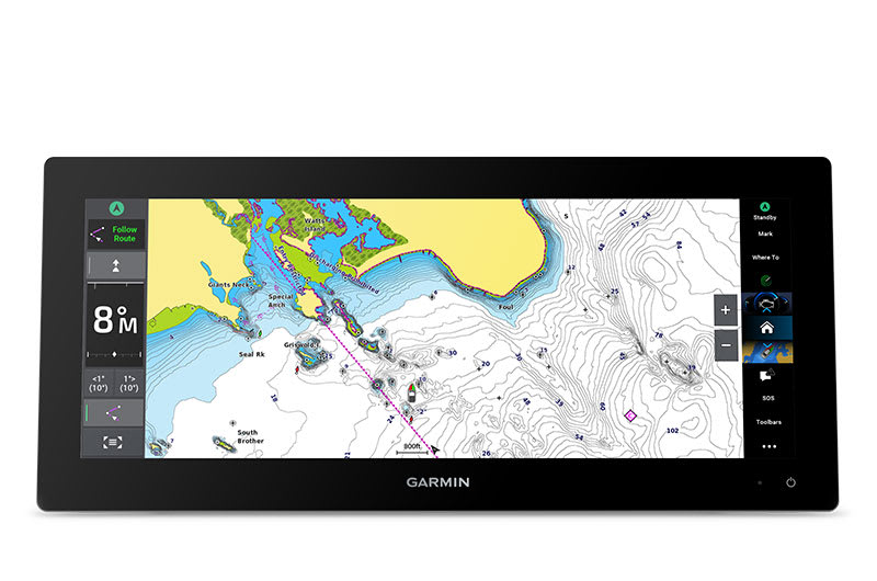
PRELOADED MAPPING
Experience unparalleled coverage and detail with built-in Garmin Navionics+ integrated coastal and inland mapping that includes Auto Guidance+™ technology2 and a 1-year subscription for downloadable daily updates and more on select models.
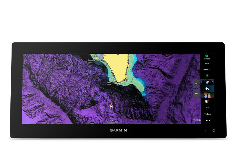
OPTIONAL CHARTS AND MAPS
Bring premium chart features to your chartplotter with an optional upgrade to a Garmin Navionics Vision+™ subscription, featuring downloadable high-resolution relief shading, satellite imagery, sonar imagery and more.

Sail and navigate with ease.
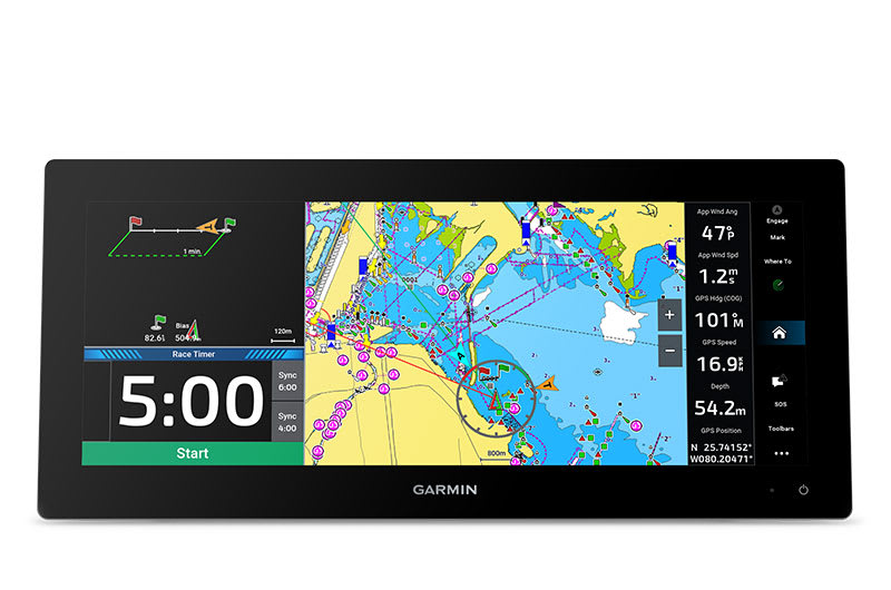
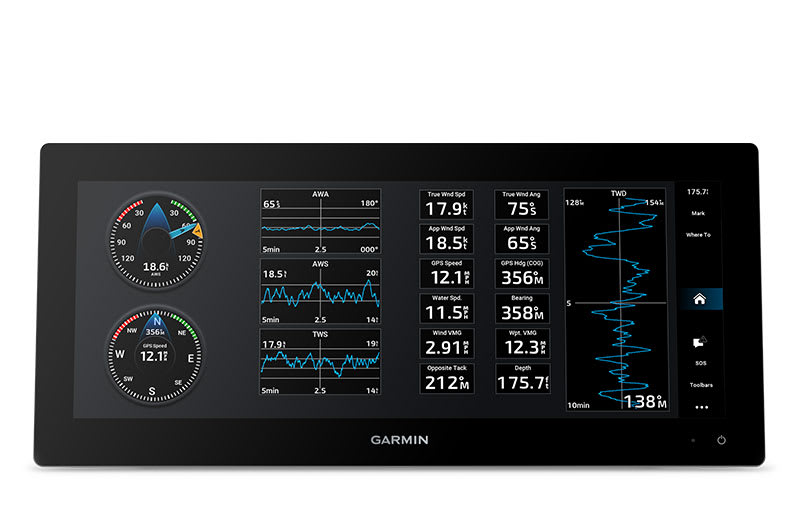
GARMIN SAILASSIST™ SAILING FEATURES
View laylines, race start line guidance, enhanced wind rose, heading and course-over-ground lines, true wind data fields and tide/current/time slider, wind angle, set and drift, wind speed and more.
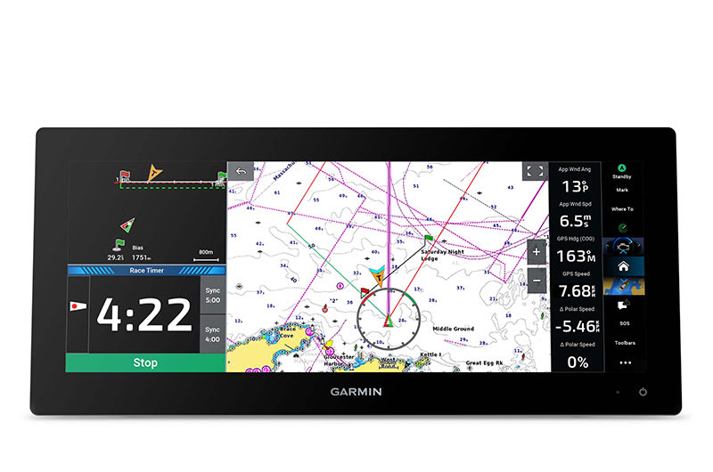
SAILING POLARS
Use the polar table to see key data, including how fast you should go at a certain wind angle and speed — so you know whether you need to adjust sail trim.
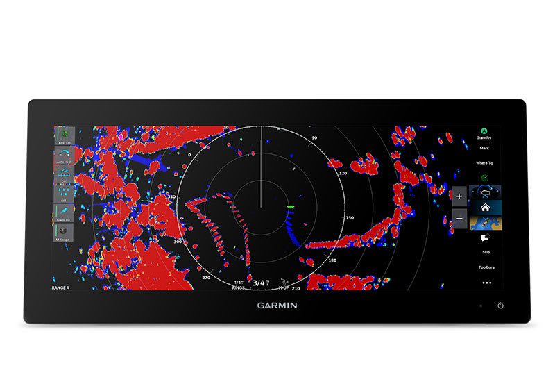
GARMIN MARINE NETWORK
If you have multiple compatible Garmin devices on your boat, you can share information — such as maps, user data, radar and IP camera video — among them.
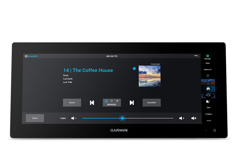
NMEA 2000® AND NMEA 0183 NETWORKS
Connect to compatible autopilots, digital switching, weather, the Fusion® audio system, media, VHF, AIS and more from one screen.
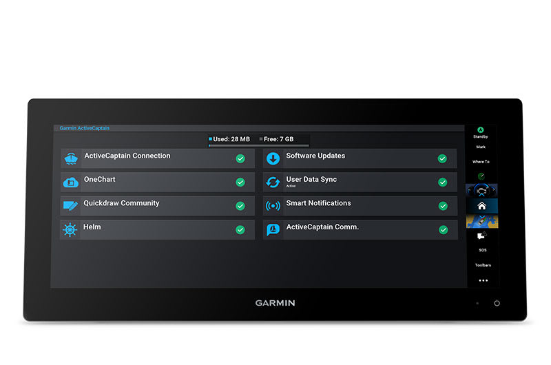
ACTIVECAPTAIN® APP
Built-in Wi-Fi® connectivity pairs with the free all-in-one mobile app for access to the OneChart™ feature, smart notifications (when paired with your smartphone), software updates, Helm™ app, Garmin Quickdraw™ Community data and more1.
INTEGRATED ANT® TECHNOLOGY
Connect with some of your favorite devices, such as quatix® marine watches, gWind™ Wireless 2 transducers, GNX™ Wind marine instruments and wireless remote controls.
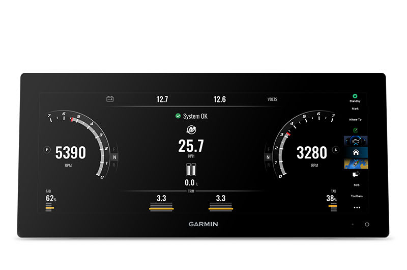
ENGINE CONNECTIVITY
You can connect your chartplotter to different engines, including select Yamaha® and Mercury® engines.
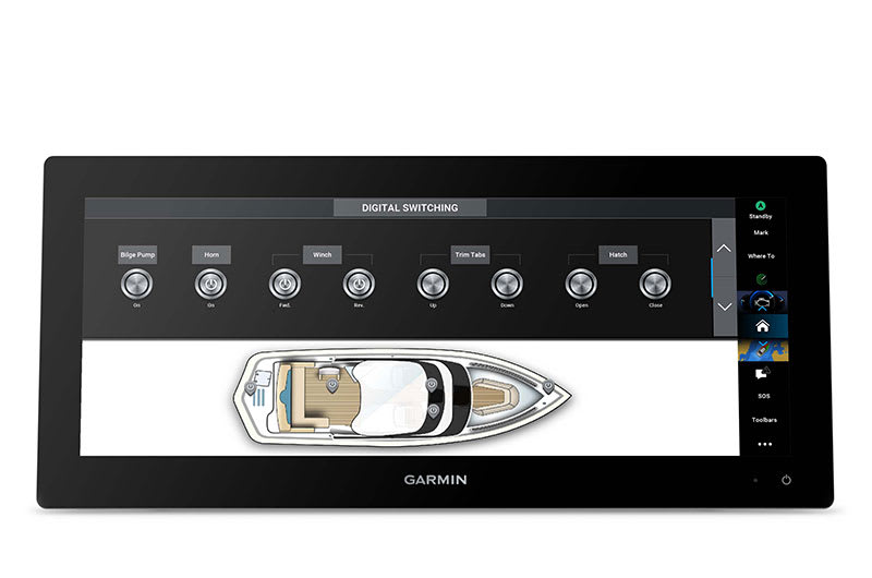
ONEHELM FEATURE
This feature brings together all of the operations and capabilities of EmpirBus™ digital switching and other third-party devices on one screen.

SEND INREACH® DEVICE MESSAGES
Pair your inReach satellite communicator3 to your chartplotter, and type custom messages by using your MFD’s on-screen keyboard. Access your contact list, or enter an email, inReach address or phone number. You can also group messages by conversation for a texting-like experience.

Connect with additional boat control options.
POWER-POLE® SHALLOW WATER ANCHOR
By networking the GPSMAP 15x3 chartplotter with your Force® trolling motor and your compatible Power-Pole shallow water anchoring system, you can access advanced boat control features4 from your plotter, including smart anchor auto-deployment, smart anchor jog, auto stow, anchor drag detection and end-of-route anchoring. Spend more time fishing, less time positioning.