- Description
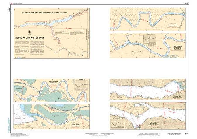
Chart 3050 - Kootenay Lake and River
*Charts are usually shipped folded, if rolled extra freight charges will apply.
KEY INFORMATION:
- Coverage: Details Kootenay Lake, from its southern inflow near Kuskanook to its outlet near Balfour and the subsequent Lower Kootenay River down to where it meets the Columbia River.
- Scale: Often listed at a scale of 1:75,000.
- Content: Includes depths (bathymetry), bottom characteristics, shore details, buoys, lights, and other navigational features.
- Format: Typically a 2-sheet paper chart set
ABOUT KOOTNEY LAKE & RIVER:
- Geography: A long, deep, U-shaped glacial lake with steep sides, fed by major rivers like the Kootenay, Duncan, and Lardeau.
- Dams: The waterway is significantly managed by structures like the Corra Linn Dam and Bonnington Dams, affecting water levels and flow.
- Significance: A popular area for fishing, sailing, and recreation, necessitating reliable charts for all users