- Description
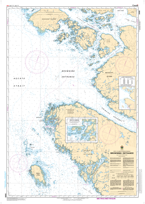
Chart 3986 - Browning Entrance
(Before 3927, 3723 - Replaced by 3986)
*Charts are usually shipped folded, if rolled extra freight charges will apply.
KEY INFORMATION:
- Area Covered: Browning Entrance, likely near Browning Island in British Columbia, offering detailed views for local navigation.
- Content: Standard nautical chart details, including soundings (depths), depth contours, navigation lights, buoys, wrecks, obstructions, and topographic features, all standardized for SOLAS compliance.
- Purpose: Essential for safe boating and commercial shipping in the covered area, as mariners are required to use CHS charts