- Description
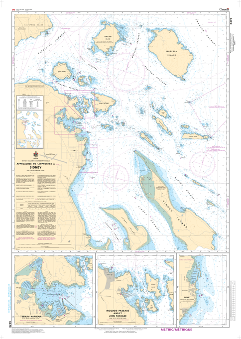
Chart 3479 - Approaches to/Approches à Sidney
(Before 3476 - Now Replaced by 3479)
*Charts are usually shipped folded, if rolled extra freight charges will apply.
KEY INFORMATION:
- Chart Number: 3479
- Region: Pacific Coast
- Coverage Area: Focuses on the approaches to Sidney, including James Island, Sidney Island, Moresby Island, and the busy ferry corridors.
- Scale: 1:20,000, making it a detailed harbour/approach-level chart suitable for inshore navigation.
-
Navigation Details: Provides,, bathymetry (depth soundings in meters), shore characteristics, and precise locations for:
- Submerged rocks, kelp beds, and shoals.
- Navigational aids (buoys, lighthouses).
- Anchorage locations and piers/wharves.
- Language: Bilingual (English and French)