- Description
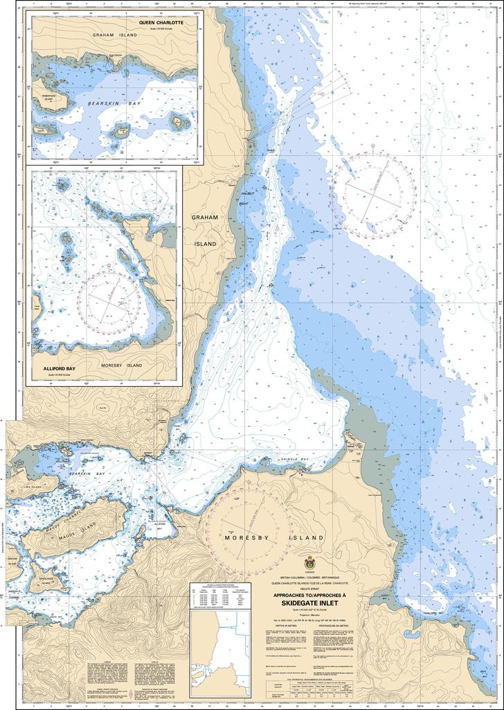
3890 - Approaches to/Approches à Skidegate Inlet
*Charts are usually shipped folded, if rolled extra freight charges will apply.
KEY INFORMATION:
- Chart Name: 3890 - Approaches to/Approches à Skidegate Inlet
- Publisher: Canadian Hydrographic Service (CHS)
- Scale: 1:40,000
- Region: Pacific Coast (Central Haida Gwaii / Hecate Strait)
- Skidegate Bar & Entry: High-resolution mapping of the entrance channels, highlighting shifting sandbars and drying hazards.
- Sandspit & Daajing Giids: Detailed coverage of the approaches to the Sandspit wharf and the Daajing Giids (formerly Queen Charlotte) waterfront.
- Navigation Aids: Marks all buoys, lights, and beacons.
-
Anchorage Information: Includes sea-floor characteristics (sand, mud, rock)