- Description
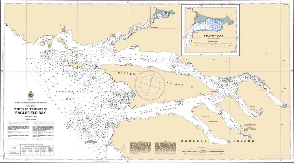
Chart 3865 - Vicinity of Englefield Bay
*Charts are usually shipped folded, if rolled extra freight charges will apply.
KEY INFORMATION:
- Coverage: Englefield Bay, Kaiser Island, and the approaches to Moore Channel (West Coast of Moresby Island, BC).
- Scale: 1:36,600 or 1:20,000 depending on the specific, edition/representation.
- Publisher: Canadian Hydrographic Service (CHS).
-
Key Features:
- High-Resolution Mapping: Covers intricate island, groups, and, deep-water inlets,.
- Hazard Identification: Details Denham Shoals, reefs, and sea, stacks,.
- Bathymetric Data: Shows water depths and sea-bottom, characteristics, (rock, sand, mud).
-
Navigational Aids: Marks, markers, and, navigational, hazards,.