- Description
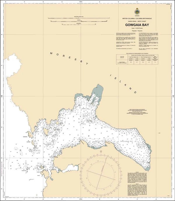
Chart 3864 - Gowgaia Bay
*Charts are usually shipped folded, if rolled extra freight charges will apply.
KEY INFORMATION:
- Description: This is a, high-detail,, 1:15,000 to 1:18,254 scale paper chart for navigating the rugged shoreline of southern Moresby Island.
- Coverage: Covers Gowgaia Bay, including approaches to Goski Bay.
-
Key Features:
- Bathymetry & Seafloor: Provides precise water depths and bottom types (rock, sand, mud) for finding safe anchorages in deep fjords.
- Hazards: Identifies drying reefs, submerged rocks, and kelp forests.
- Topography: Includes shoreline details and land elevations for visual navigation.
-
Details:
-
Purpose: Essential for fishing, eco-tourism, and research vessels in Gwaii Haanas.
-
Purpose: Essential for fishing, eco-tourism, and research vessels in Gwaii Haanas.