- Description
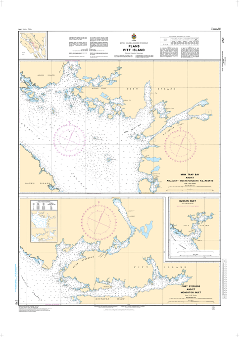
Chart 3721 - Plans Pitt Island
*Charts are usually shipped folded, if rolled extra freight charges will apply.
KEY INFORMATION:
- Region: Pacific Coast, Canada (Northern British Columbia).
- Purpose: Provides high-resolution, "ground-truth" data for navigating rugged harbors and inlets on the west coast of Pitt Island.
- Scale: 1:18,337.
-
Key Coverage Areas:
- Mink Trap Bay & Adjacent Inlets: Detailed, high-resolution mapping of inlets and narrow passages.
- Port Stephens & Monckton Inlet: Critical, detailed coverage for commercial fishing vessels and recreational cruisers.
- Buchan Inlet: Technical entrance details including bathymetry.
-
Details Included:
- Detailed bathymetry (depths) and shoreline configurations.
- Seafloor characteristics (rock, sand, mud).
- Navigational aids (buoys, lights).
-
Hazard identification.