- Description
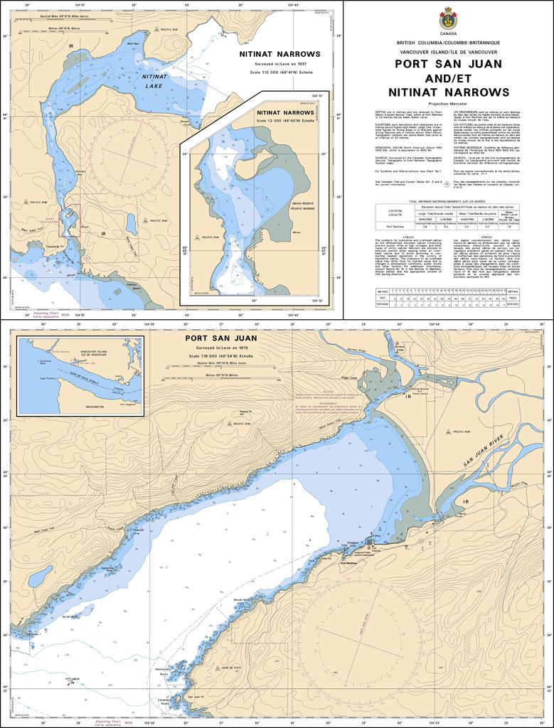
Chart 3647 - Port San Juan and/et Nitinat Narrows
*Charts are usually shipped folded, if rolled extra freight charges will apply.
KEY INFORMATION:
- Chart Number: 3647
- Coverage: Port San Juan and Nitinat Narrows (Southwest Vancouver Island)
- Scale: 1:18,000
- Region: Pacific (Canada)
- Port San Juan: Detailed depths, coastline, and navigation aids for the bay near Port Renfrew.
- Nitinat Narrows: Specific navigational details for the shallow, narrow passage leading into Nitinat Lake.
- Navigation Hazards: Clearly marked, including rocks, shoals, and reefs.
- Aids to Navigation: Lights, buoys, and markers are plotted to assist in navigation.
- Topography: Coastal features, elevations, and shoreline, essential for identifying the area.
- Submarine Cable/Pipe: Recent updates in the area (2025) note new fibre-optic cables