- Description
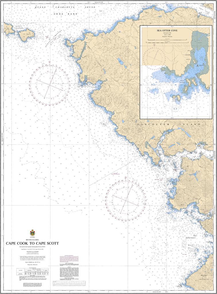
Chart 3624 - Cape Cook to Cape Scott
*Charts are usually shipped folded, if rolled extra freight charges will apply.
KEY INFORMATION:
- Chart Number: 3624.
- Title: Cape Cook to Cape Scott.
- Region: Pacific Coast (Vancouver Island's northern tip).
- Scale: 1:90,000 (1 nautical mile on the chart equals 90,000 nautical miles in reality).
- Content: Depths, seabed types, coastlines, hazards, aids to navigation (buoys, lights).