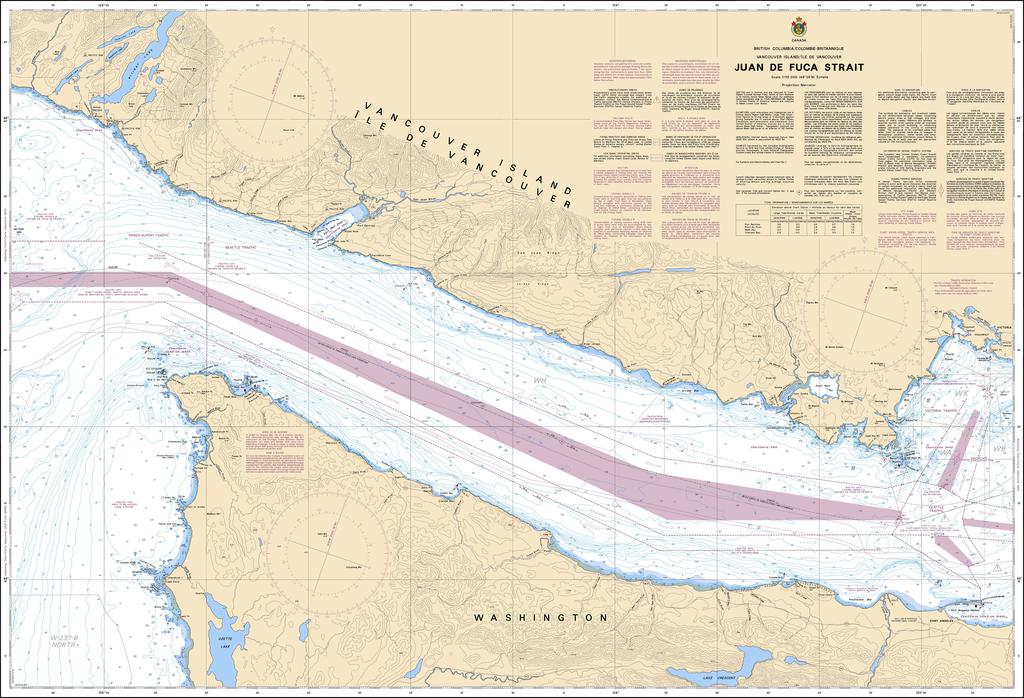
- Description
Chart 3606 - Juan de Fuca Strait
*Charts are usually shipped folded, if rolled extra freight charges will apply.
KEY INFORMATION:Â
- Area Covered: The Juan de Fuca Strait, a major waterway connecting the Pacific Ocean to the Salish Sea (including Puget Sound).
- Purpose: Official chart for safe navigation, detailing depths, seabed, coast, hazards, and navigation aids.
- Scale: 1:110,000, providing significant detail for its area.
- Format: Available as print-on-demand on paper or synthetic waterproof material, often shipped rolled or folded.
- Key Features (on chart): Includes traffic separation schemes, buoy information (like Light Buoy J), Racon signals, and coordinates for navigational aids
- Depths & Seabed: Essential for avoiding grounding, with data on water depths and seabed composition (e.g., mud, rock).
- Coastline: Detailed configuration and characteristics of both the Canadian (Vancouver Island) and U.S. (Olympic Peninsula) shores.
- Dangers: Locations of rocks, reefs, and other hazards to navigation.
- Aids to Navigation: Positions of buoys, lights, and other markers.
- Traffic Lanes: Designated routes for vessels, critical in this busy strait.