- Description
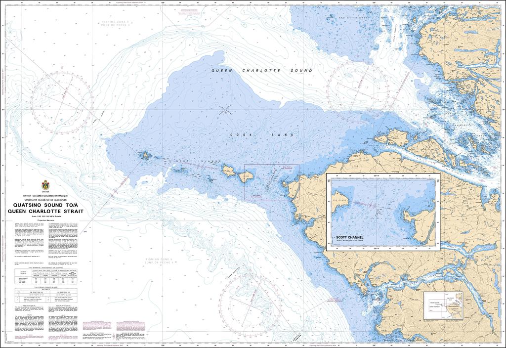
Chart 3605 - Quatsino Sound to Queen Charlotte Strait
*Charts are usually shipped folded, if rolled extra freight charges will apply.
KEY INFORMATION:
- Title: CHS Chart 3605: Quatsino Sound toƒ Queen Charlotte Strait.
- Scale: 1:150,000 (Main Chart) with an inset plan of Scott Channel at 1:80,000.
- Coverage: Maps the waters from Quatsino Sound (Vancouver Island) northwards towards Queen Charlotte Strait, a significant stretch of British Columbia's coast.
- Content: Shows depths, sea bottom types, coastlines, dangers (rocks, shoals), aids to navigation (buoys, lights), and land features for safe navigation.