- Description
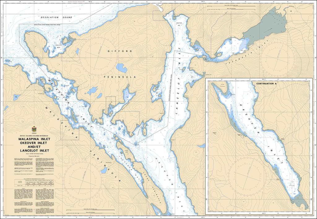
Chart 3559 - Malaspina Inlet, Okeover Inlet and/et Lancelot Inlet
*Charts are usually shipped folded, if rolled extra freight charges will apply.
KEY INFORMATION:
- Coverage Area: Covers the intricate waterways of Malaspina Inlet, Okeover Inlet, and Lancelot Inlet (near Powell River/Desolation Sound area).
- Scale: A large scale (1:12,000), ideal for close-quarters navigation in complex, shoal-filled waters.
- Content: Shows depths, seabed characteristics, shore details, hazards (rocks, reefs), and navigation aids (buoys, lights).