- Description
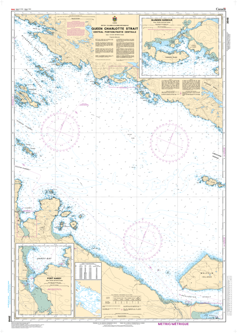
Chart 3548 - Queen Charlotte Strait, Central Portion/Partie Centrale
*Charts are usually shipped folded, if rolled extra freight charges will apply.
KEY INFORMATION:
- Location: Queen Charlotte Strait, Central Portion (British Columbia, Canada).
- Key Features: This chart provides critical, detailed information for navigating this specific, treacherous, or high-traffic area, including water depths (bathymetry), sea bottom characteristics, coastal configuration, elevations, and navigational aids (buoys, lights).
- Purpose: It ensures safe navigation for mariners traveling between ports, assisting in identifying potential hazards
- Chart Number: 3548
- Scale: 1:40,000
- Updates: The chart is typically updated with the latest Notices to Mariners (NOTMARs) by retailers before shipping.
-
Navigation Notes: Due to the complexity of the area, mariners are advised to use the latest, updated charts