- Description
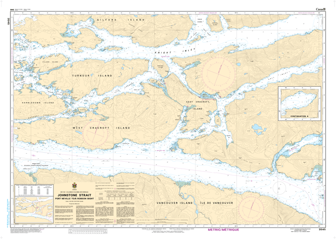
Chart 3545 - Johnstone Strait, Port Neville to Robson Bight
*Charts are usually shipped folded, if rolled extra freight charges will apply.
KEY INFORMATION:
- Geographical Coverage: Focuses on the Johnstone Strait area, specifically from Port Neville to Robson Bight.
- Included Locations: Details key areas including West and East Cracroft Island, Turnour Island, and surrounding waterways.
- Purpose: Designed for safe navigation, providing accurate depths, shorelines, and navigational hazards.
- Marine Protected Areas: Includes information on Rockfish Conservation Areas in the vicinity
- Chart Number: 3545
- Scale: 1 : 40,000
-
Region: Pacific Coast