- Description
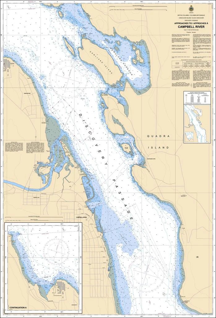
Chart 3540 - Approaches to/Approches à Campbell River
*Charts are usually shipped folded, if rolled extra freight charges will apply.
KEY INFORMATION:
- Chart Identifier: CHS Chart 3540, "Approaches to/Approches Campbell River".
- Coverage: Focuses on Discovery Passage, leading into Campbell River, including significant features like Seymour Narrows, Duncan Bay, and the Strait of Georgia's northern part.
- Purpose: Provides essential details for mariners, including depth soundings, channel outlines, navigation aids (buoys, lights), and potential hazards.