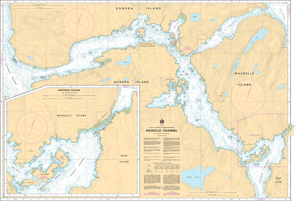
- Description
Chart 3537 - Okisollo Channel
*Charts are usually shipped folded, if rolled extra freight charges will apply.
KEY INFORMATION:
- Identifier: CHS Chart 3537.
- Title: Okisollo Channel.
- Region: Pacific Coast, near Quadra and Cortes Islands, Central Vancouver Island.
- Scale: 1:20,000, indicating high detail for close navigation.
- Purpose: To show water depths, sea bottom nature, coastlines, dangers, and navigation aids for safe marine navigation.
- Associated Areas: Provides access to Surge Narrows Provincial Park via the north, connecting to Hoskyn Channel