- Description
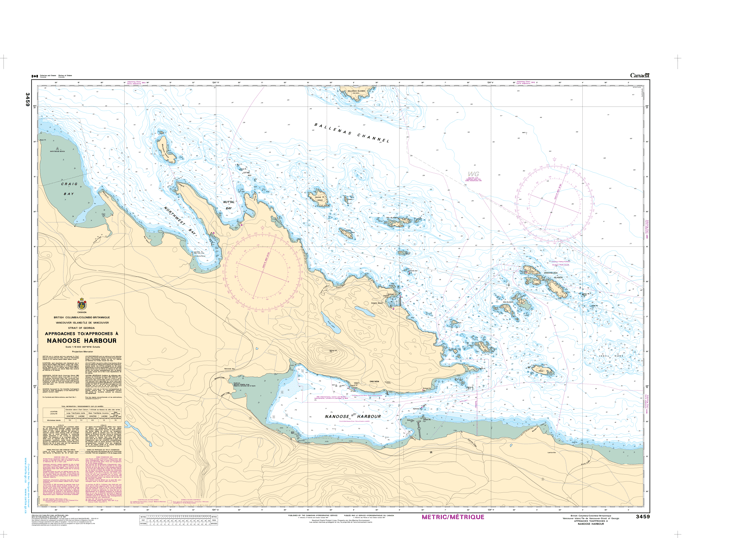
Chart 3459 - Approaches to/Approches à Nanoose Harbour
*Charts are usually shipped folded, if rolled extra freight charges will apply.
KEY INFORMATION:
- Coverage Area: Approaches to Nanoose Harbour (Vancouver Island East).
- Scale: 1:15,000.
- Region: Pacific Coast, Canada.
- Navigation Safety: Includes detailed soundings (depths), navigational aids, and hazards to navigation.
- Anchorage Areas: Identifies specific areas suitable for anchoring, typically marked with an anchor symbol.
-
Chart Data: The chart shows depths in metres and decimetres (up to 30 metres) or just metres (deeper water).