Skip to product information
1 of 1

Canadian Hydrographic Services

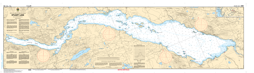
Chart 3080 - Stuart Lake

Chart 3080 - Stuart Lake

MPN # Chart 3080 - Stuart Lake SKU # 3080C
$12.00 CAD
Regular price Sale price $12.00 CAD
"CONTACT FOR DETAILS AND INSTORE SPECIAL PRICING"
Shipping calculated at checkout.
SIZE

⚠️ Important Pickup Information

While our retail store carries a wide selection of products shown on this website, it is not possible to stock all 80,000+ products in-store.

Please place your order online or call us before driving to the store to confirm inventory availability.

If the item is not available in-store, we can usually transfer it from our warehouse within 2–5 business days, and we'll notify you as soon as it is ready for pickup.

  • American Express
  • Apple Pay
  • Diners Club
  • Discover
  • Google Pay
  • JCB
  • Maestro
  • Mastercard
  • PayPal
  • Shop Pay
  • Union Pay
  • Visa
  • Free shipping on most orders over $120across Canada exceptions apply
View full details
  • Description

Chart 3080 - Stuart Lake

*Charts are usually shipped folded, if rolled extra freight charges will apply.

KEY DETAILS:

  • CHS Chart 3080: A nautical map of Stuart Lake for navigation.
  • Location: Stuart Lake (Nak'albun in Carrier language) in Northern BC, near Fort St. James

CHART SPECIFICATIONS:

  • Scale: Typically 1:50,000.
  • Region: Pacific Coast.

WHAT IT'S USED FOR?

  • Boating, fishing, and exploring the Stuart-Trembleur-Takla waterway system